juice wrote:Thanks for the advice on exporting GPX files. I use an iPhone as a gps, one problem with web based apps is using them where there is no signal, where I ride this is often.. I currently use an app called mapout which I think uses the open cycle/streets maps. It has the capacity to allow the user to download sections of the map for offline use. Could this be done with this app.
Richard Fairhurst wrote:... juice: ... but in the meantime you can load cycle.travel's GPX files into MapOut by registering with them and then emailing the files to the special email address they give you.
And/or you can use AirDrop (or any other mechanism) to send the gpx to the iPhone and then when the "Open In ..." options pop-up, MapOut will be in the list - which will import the gpx into MapOut. Unfortunately one thing you can't use is iTunes File sharing (but that is rather poor anyway so it's not much of a limitation).
n.b. I am very impressed with MapOut as an app, except it is still early days and it still has rather a lot of bugs that the dev team are rather slow about addressing. None of the bugs are a "disaster" and the app still works and I still consider it way superior to the other comparable apps; but the bugs just get rather irritating.
Looks like this could be useful planner but it's a bit too keen to avoid A-roads at all costs IMO. I've tried creating some local routes and check out these (short extracts from longer routes) near Didcot. The A4130 is a pretty quiet road and there isn't a lot of option nearby, but the routing really wants to go along the muddy bridleway to avoid a couple of hundred metres of tarmac. If I drag the finish point a bit further it wants to go via Featherbed Lane and the A417 which is a much busier A-road and obviously much further. I couldn't get it to avoid that bridleway on any route that came near the A4130 without adding several extra control points (try routing between Abingdon and Wantage for example.
Other than this example it seems to create decent routes if you're happy to use NCN routes between destinations and I will try it out for real at some point
It tries to be clever about A-roads by rating each one with the actual traffic volume on the road - but there's some margin of error as the OpenStreetMap data doesn't always fit nicely with the traffic counts!
On the issue of that track - it's currently marked in OSM as having a grass surface. Would you say "dirt" is more accurate? If so, I can change it, which will further downrate it in cycle.travel's routing.
cycle.travel - maps, journey-planner, route guides and city guides
Richard Fairhurst wrote:It tries to be clever about A-roads by rating each one with the actual traffic volume on the road - but there's some margin of error as the OpenStreetMap data doesn't always fit nicely with the traffic counts!
On the issue of that track - it's currently marked in OSM as having a grass surface. Would you say "dirt" is more accurate? If so, I can change it, which will further downrate it in cycle.travel's routing.
I understand there will be some discrepancies and A-roads will vary considerably on time of day! That track is a byway with a dirt/loose surface, OK on mountain bikes and wider tyred tourers in the dry but not suitable for road bikes. A bit difficult to see on Google Streetview but here's one end of it! https://goo.gl/maps/OJMFk
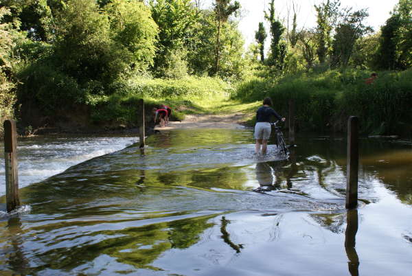
Just tried it for some routes from home to Gloucester which I will be riding later in the month and it comes up with some really sensible routes. Liking it. The only oddity I found is I had to route it around the bridleway ford over the Thames at Duxford as that's for the brave on low flows only!!
Evening all Is anyone having trouble using tcx files? I'm using a Garmin Edge Touring, all up to date, but it wont work with tcx. When I've downloaded route to garmin(in tcx) and then open it on my device it shows this: In summary, everything shows as zero. In map, I just get half a blue screen and half white. In elevation, nothing, just a grid. I've copied the route to ridewithgps and it works fine on that, just not here for some reason. Any ideas anyone?
houndlegs wrote:Evening all Is anyone having trouble using tcx files? I'm using a Garmin Edge Touring, all up to date, but it wont work with tcx. When I've downloaded route to garmin(in tcx) and then open it on my device it shows this: In summary, everything shows as zero. In map, I just get half a blue screen and half white. In elevation, nothing, just a grid. I've copied the route to ridewithgps and it works fine on that, just not here for some reason. Any ideas anyone?
I have the same problem with TCX files on the edge touring. I use gpx format which works fine, except it doesn't send the altitude. You also have to rename it on the device as the file defaults to ACTIVE.
geocycle, yeah, I can use gpx fine just not tcx. Its not the end of the world, but I started using tcx because it also gave me a little write up on the bottom of the screen, which I liked. Like I said, I can use tcx on ridewithgps, but not on this planner. Which is a shame because I much prefer the routes this one uses.
Brilliant tool which I've only just discovered. Yesterday it found me a great circular route (for gentle exercise/teashop/pub purposes) from my home near Hitchin to Stagsden (near Bedford). Perfectly rideable even on an old roadbike with 23mm tyres, with some sections I would never have found myself.
But when I got back and had a look on OS mapping at where I had been, I found one of the nicest stretches was marked as a footpath, so not legally rideable. Was tempted to edit that section on OSM (where it's marked as a cycle path!) but didn't, in the end, because I rather liked being routed on it.
Are you sure it's not a footpath with permission to cycle? There's a few of them about. It's not as open and shut as a footway (alongside a carriageway).
MJR, mostly pedalling 3-speed roadsters. KL+West Norfolk BUG incl social easy rides http://www.klwnbug.co.uk All the above is CC-By-SA and no other implied copyright license to Cycle magazine.
mjr wrote:Are you sure it's not a footpath with permission to cycle? There's a few of them about. It's not as open and shut as a footway (alongside a carriageway).
Well perhaps. I'm referring to the loop of path to the south of the Priory Country Park east of Bedford, on the north bank of the Great Ouse and south of NCN 51. Marked as an fp (part of the Ouse Valley Way) by the OS, as a cycle path by OSM.
I've done a bunch of work today on the GPS downloads:
TCX should now work properly on Garmins - I've tested it on BaseCamp and Training Center and it works fine, though I don't have a new Garmin unit to test with;
GPX route option for those who prefer them to tracks;
KML option for Google Earth and the like;
Names come from the title of your saved route, rather than just 'cycle_travel.gpx' or 'ACTIVE LOG';
Safari now downloads the file automatically, though you still have to rename it manually from 'Unknown' to 'track.gpx' or whatever
(TCX really is an accursed format - turns out that Training Center, at least, squawks if two trackpoints have exactly the same location, which rather kiboshes circular routes. I've worked around it...)
cycle.travel - maps, journey-planner, route guides and city guides